20220905 Second annual Paddle to Death. Overnight trip with 28 miles of paddling. Put in at Krogh's Landing on the Straight River and got out of the Cannon River at Riverside Park in Northfield. Water levels were low to medium. The Straight River presented us with lots of rocks, some snags and sections of fast flowing water. The challenge was to avoid the shallow areas where the kayaks would scrape, and the rocks in the riffle patches where the elevation dropped. The rocks could easy catch a kayak, turn it sideways and tip it, allowing water to flow in. The Cannon was a bit of an easier ride. The water levels were higher, and the biggest safety risk was downed trees with branches submerged just below the water. The water was slowly moving so it was reasonable to avoid the obvious snags but the paths the looked clear had hidden dangers just below the surface. Like the rocks in the riffle patches, they could catch a kayak and turn and tip it leading to a capsize. We enjoyed forested view with beautiful rock walls and outcroppings and many birds. We saw many blue herons and Bald Eagles. Several of the Bald Eagles were still juveniles noted by the lack of the white head and tail. We also saw some cityscapes in Fairbault and went through a stretch of river under several bridges.
We had planned to camp at a boat access site within the Cannon River Wilderness Park but ended up on a sand bar on state land because we ran out of day light and were concerned about everyone's safety with all the snags and rocks we had encountered. It was difficult enough to stay up right in the daylight. Note that camping is often not allowed on sandbars or elsewhere on most state lands. We had a great meal of Ranch Burgers and Au Gratin potatoes heated with a campfire and backpacking stove. We soaked up the scenery, looked at stars and played Uno. The bugs were humming away (thankfully not biting much) and we could hear a few birds including the Barred Owl calling in the night. There was a group of 6 Bald Eagles sitting in a treetop watching us as the sun was going down. Apparently, there was a chance to see the Northern Lights, but the only Northern Lights we saw were stars, light pollution and aircraft! The moon was a waxing gibbous and with the clear sky provided light throughout the night. I could hear a beaver slapping its tail in the night and Tiff saw a couple of them swimming together in the early morning. Sounds like someone doing a bellyflop!
In the morning we had a hearty breakfast with eggs, cheese, sausage and oatmeal, packed up and got on the water around 10:00. We continued to enjoy mostly forested views with some sheer rock walls and bluff formations. When we reached the Cannon River Wilderness Park, there were lots of round boulders scattered about the river. We checked out the facilities. A clean outhouse, nice picnic shelter, well-kept gravel parking area and lawn at the entrance. I never found the water that was listed on the map. I found something that looked like a well. Maybe they took the pump off for the season? We also checked out the campsites that we could find. Nothing to write home about. They looked as if they could use some maintenance. We only found one out of the 4 sites marked with a sign. The landings were overgrown and tricky to spot. The sites are free to use though so one shouldn't be too picky.
When we reached Dundas, we came upon a notable old stone structure partially in the river called the Archibald Mill. I read about the mill a bit and apparently it got some power from a water wheel that was within the building and that is why the structure is partially in the river. There was a fire, and the mill was never restored after that. I also learned that the Cannon River had several mills along its banks in the area between Faribault and Northfield.
Towards the end Mikey started to take on water. A few times an hour he was pumping his kayak out with a manual bilge pump. When we landed, he found a hole in his kayak, thinking it was caused by one of the many rocks we got hung up on during the trip.
 |
| Packing up camp in the morning |
 |
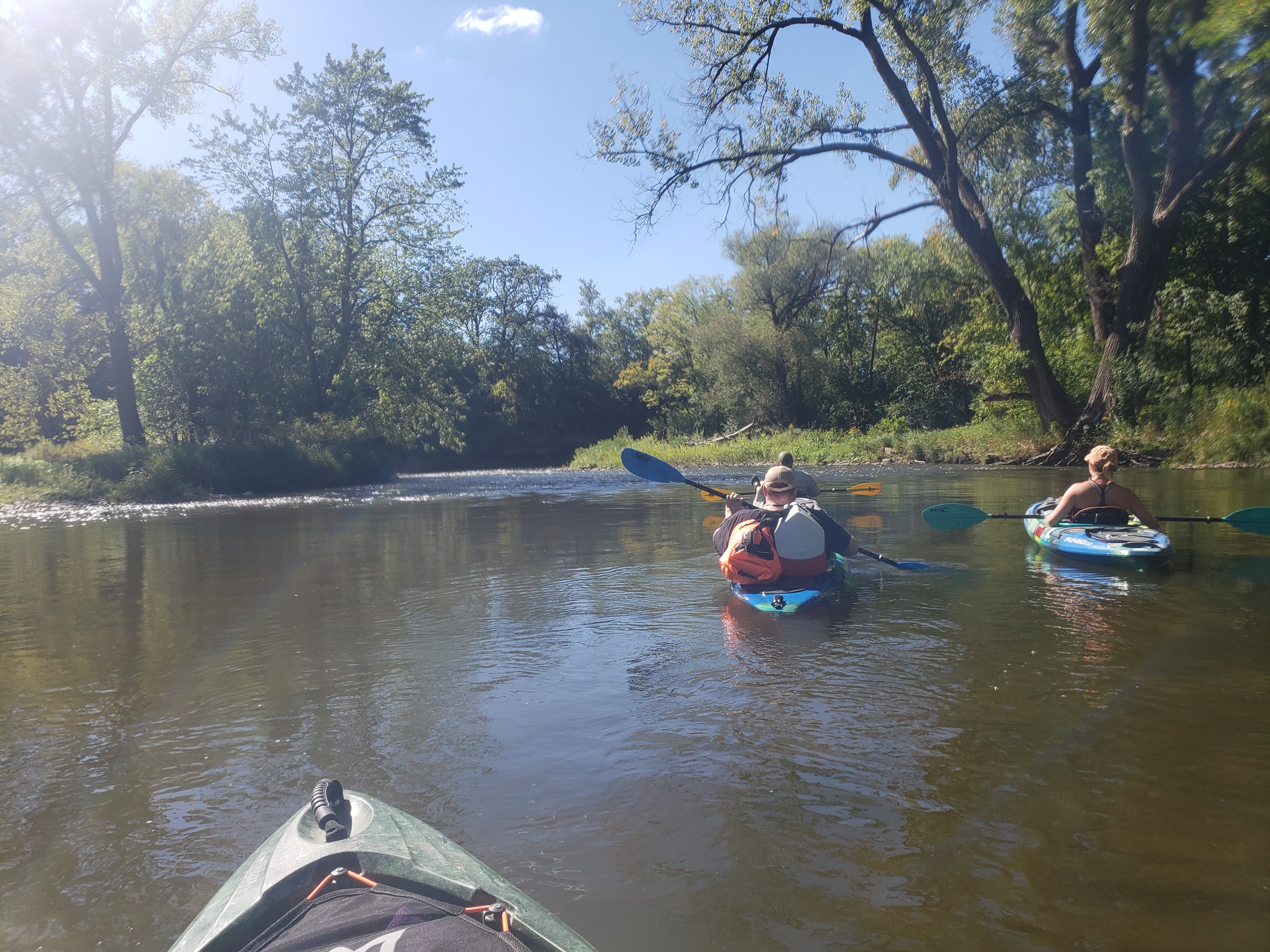
| Caution ahead, lots of downed trees, be weary of what is just under the water |
 |
| Entrance to the Cannon River Wilderness Park |
 |
| Carry in boat launch and path to outhouse and picnic shelter at Cannon River Wilderness Park |
 |
| Outhouse, picnic shelter and parking at Cannon River Wilderness Park |
 |
| Example of water access campsite (Cannon River Wilderness Park) |
 |
| Water access campsite fire pit and bench (Cannon River Wilderness Park) |
 |
| Water Access campsite sign |
 |
| Water access campsite landing, sign hiding in trees |
 |
| Dundas and the Archibald Mill ruins |
Conditions during our trip according to the Minnesota DNR:
Cannon River at Co. Hwy. 29 below Faribault, MN
raw levels: 9.60 ft (2022-9-4 8:15 CST)
discharge: 228.00 cfs (2022-9-4 8:15 CST)
raw levels: 9.46 ft (2022-9-5 13:15 CST)
discharge: 200.00 cfs (2022-9-5 13:15 CST)
Straight River nr Faribault, MN (RM 8.8)
raw levels: 4.25 ft (2022-9-4 8:15 CST)
discharge: 169.00 cfs (2022-9-4 8:15 CST)


Comments
Post a Comment