I just recently finished a four night trip in the Boundary Waters Canoe Area Wilderness (BWCAW). We had a very enjoyable trip but there were a few improvements to note for next time. This post covers lessons learned and recommendations that apply to any BWCAW trip.
There were five people in our party, four adults and one 12 year old. Our trip started at entry point 35 in Isabella Lake and ended in Little Gabbro Lake entry point 33, approximately 21 river miles. We traveled from the east to the west along the Isabella River to Bald Eagle Lake, to Gabbro Lake to Little Gabbro Lake. There were notable drought conditions this year and ongoing fire risk. Campfires were banned and a significant portion of the west section of the wilderness area has been closed for weeks. As I write this there are nine fires actively burning in Northern Minnesota.
Recommendations for next time include better meal planning, bear deterrent methods and daily mile allocation. Things that went really well included my new sleeping set up, packing methods, having a rain fly and geo pdfs.
Meal Planning
We brought way too much food, eating only a quarter of what we brought! We had 2 packs full of food. We did a thorough meal planning session and had all meals and snacks covered but should have considered calories and quantity much more carefully. We ended up making a lot more work for ourselves at the portages and hanging the food packs in the trees at night. We did not put items such as peanut butter and syrup in smaller containers. We brought a smaller container of butter and it completely melted and made a mess. Thankfully I obsessively double bag items like this so it didn't get the pack dirty but it was a greasy pain to deal with the rest of the trip. The biggest food hits were single serve packs of meat such as Spam, chicken or pulled pork on a tortilla, Mac and cheese, the kind with the hydrated cheese in the pouch, instant oatmeal and flavored drink mixes such as Crystal Light Peach Tea and flavored electrolyte mixes. Trailtopia freeze dried camp meals are also a hit.
Bear Deterrent Methods
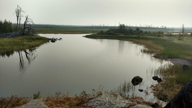
The Isabella River area that we traveled was burned in late summer 2011 in the Pagami Creek Fire. We knew it might be challenging to find trees old and tall enough to hang our food, garbage and toiletry items to keep bears and other critters out. There are no bear boxes or similar amenities at the campsites so one needs to hang items or use a bear proof container. I've never used one of the bear proof containers before and being the thrifty group that we are decided not to spend the extra money at the outfitters renting one. The first night we were able to find a couple trees that were tall enough but they didn't have any limbs remaining on them that had enough length to get the hanging bags away from the trunk easily. We had to attach a separate line to the bottom of the bags and anchor the second line at an angle to get it away from the tree trunk. We also had some trouble securing it and lost some of our height in the process of securing the rope. The second and third nights were on Bald Eagle Lake in an area not recently affected by fire. Our campsite was relatively hilly, the underbrush very thick and many of the tall trees were conifers that did not have strong, long branches. Finding an appropriate tree was incredibly difficult. We did not find a tree that would get the bags over the height of our heads and had the same issue not having enough distance from the trunk once the bags were hung. I lost some sleep the first night concerned critters were going to get our food. They didn't thankfully. Our last campsite was on Little Gabbro Lake and luckily we found a nice tree! A pulley system could have been a very helpful option in all of these scenarios or it might be worth trying the bear proof container next time! The bear proof containers are not only supposed to protect the food but significantly reduce any smells that attract bears.
 |
| Isabella River growth after 2011 fire |
 |
| Isabella River growth after 2011 fire |
Daily Mile Allocation
During our trip planning we had intended to keep our daily miles fairly easy and reasonable. My husband Chris and I kayak quite a bit in southeastern Minnesota, even in low water conditions, so we felt confident about our time calculations for the river miles. Our first night we camped along the Isabella River just to the west of Rice Lake. We had paddled about four hours our first day and had completed three portages, two short ones and one that was 109 rods. We got an early enough start and this was a reasonable day for us. We also had no competition for campsites once we were out of Isabella Lake. There was no one else out there. Our second day we had planned a six mile paddle to Bald Eagle Lake that included seven portages. We estimated two to three hours paddling time on the river plus portages. What we didn't plan for were the conditions we encountered. The Isabella river was so low in places that a couple times we had to hike through the river and pull our canoes behind us. The low water resulted in large areas of the river consisting of thick reeds making it very difficult to see and know where the river was going and where to paddle to. We watched for areas where the reeds were matted down hoping they were paths of a canoe before us. We got hung up on shallow rocks multiple times. The trick with a rock hang up is to get the weight off the spot that is stuck, usually the front of the canoe. Some of the portage landings were not accessible as they normally would be. They were more difficult to spot and we had to get out of the canoes in the water and pull them over rocks to get them up on the shore. By the time we had traveled the six miles to Bald Eagle Lake we were exhausted and it was late, around 7 pm. Way too late to be looking for a campsite. We methodically started scanning the shore for campsites. Campsite after campsite was occupied. Bald Eagle is decent size and so we were unable to see across the lake well and had to paddle more to give better visibility of several of the sites. After another 2 miles of paddling, just before dark, we finally found a site that was not occupied. This turned out to be a very poorly planned day since we didn’t give ourselves any time for unexpected issues such as the incredible low water levels and the reeds causing navigation issues. Due to the number of portages we should have given ourselves more time to find and complete them. I have added some things to my list to consider for planning next time! Lightweight binoculars would have also been incredibly helpful in locating campsites and portages.
 |
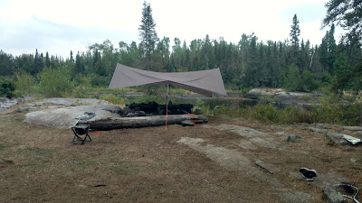
| Rain fly with 2 collapsible stakes, no trees needed! |
 |
| Little Gabbro entry point #33, muddy drought conditions. |


Comments
Post a Comment